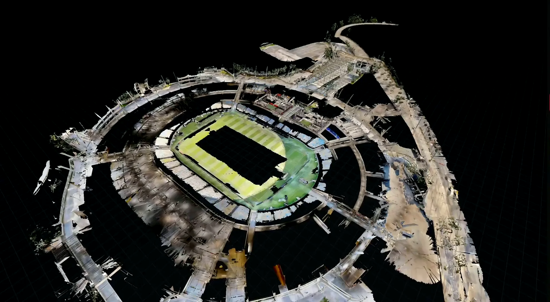
Point cloud
Registered, colorized LiDAR data of the entire venue.
E57RCPLAS
We turn stadiums, performing arts centers and event spaces into precise, decision-grade digital assets, so venue and production teams can plan with clarity, speed and fewer site visits.
Over a decade operating inside world-class stadiums, performing arts centers and international venues. We know which measurements a production team will ask for before they ask.
Every scan resolves into something your team can use: registered point clouds, measured 2D plans and CAD-ready geometry for event layouts, rentals and capital projects.
Slice the venue anywhere. Check rake, clearances and trim heights from your desk instead of on another site visit.
Registered, colorized LiDAR data of the entire venue.
Walk the venue remotely and share it with every team.
A full 3D cutaway that shows how every level connects.
Measured 2D plans for layouts, rentals and permits.
Point-to-point dimensions anywhere in the model.
Pin specs, rider notes, photos and video to exact locations.
Sponsor activations and shoppable spaces inside the twin.
Full-venue dollhouse: seating bowl, concourses, suites and back-of-house in one navigable model.
Generic scans give you pictures. We capture the details operators and production teams actually plan around: rigging points, load-in paths, clearances, sightlines and back-of-house.
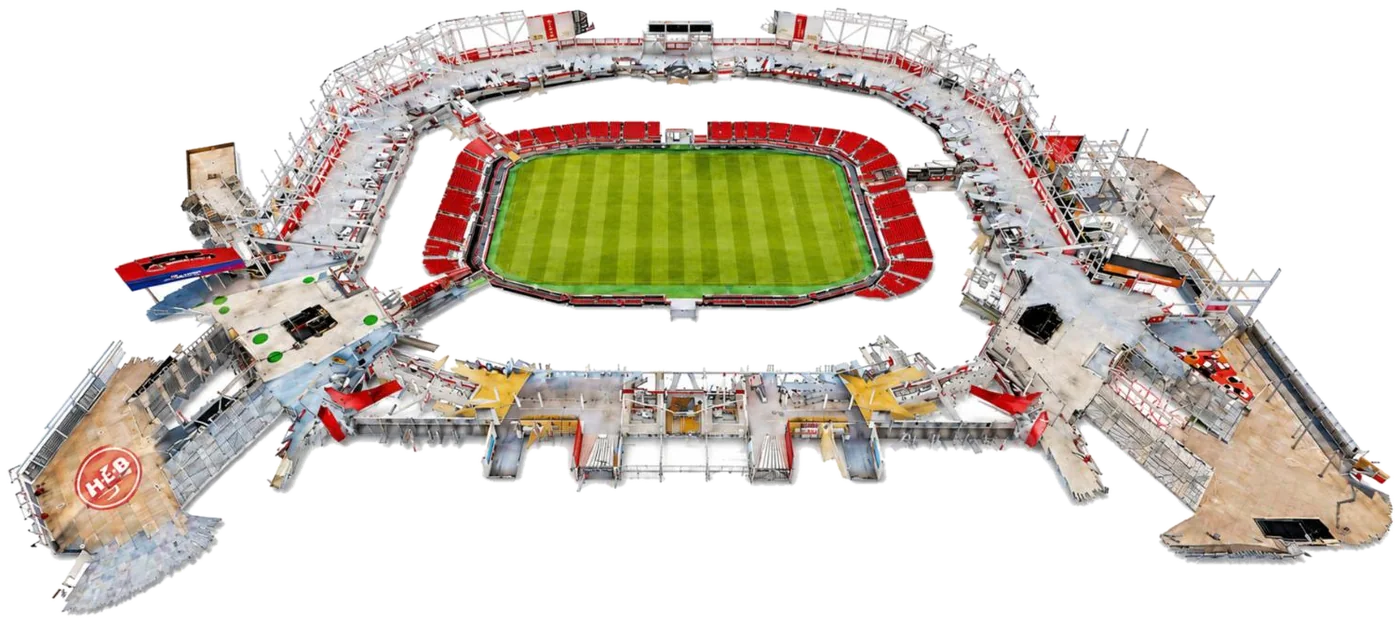
As-built twins of seating bowls, concourses and back-of-house for operations and capital projects.
Event overlays · sponsorship layouts · renovations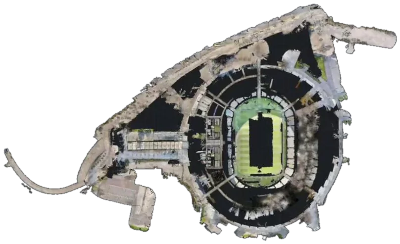
Advance every venue on the route before the trucks arrive.
Rigging · sightlines · load-in paths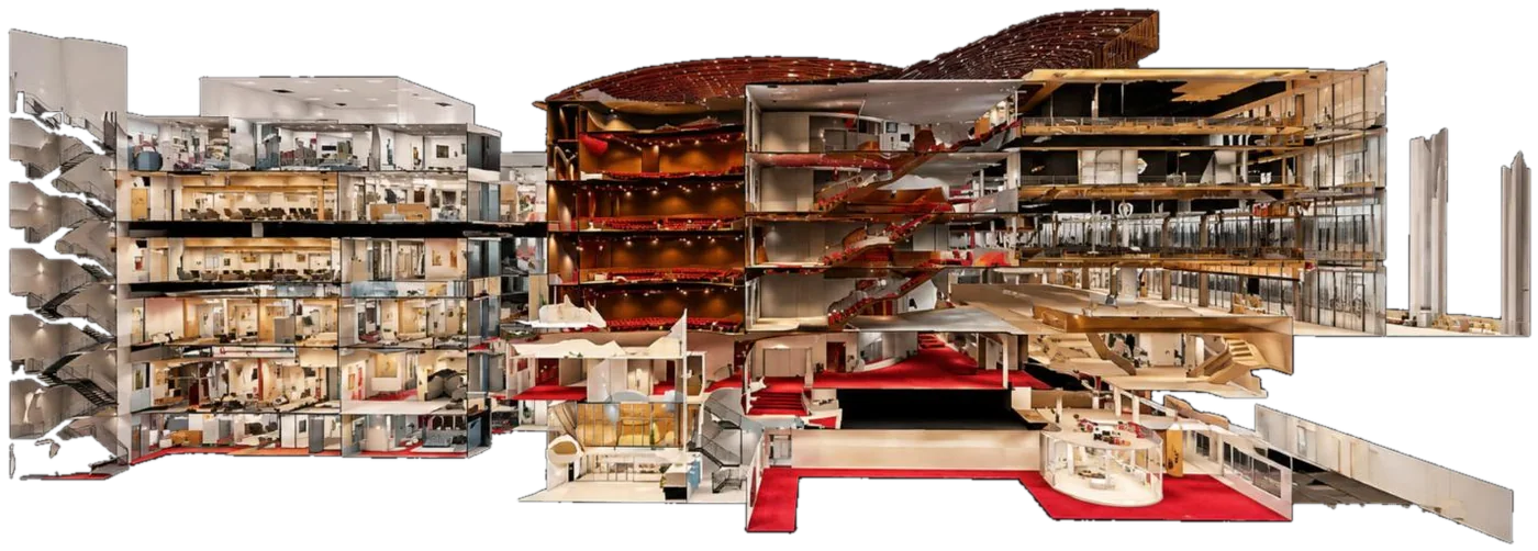 Live capture
Stage, fly system and house captured to the millimeter for design and rentals.
Set design · trim heights · seat views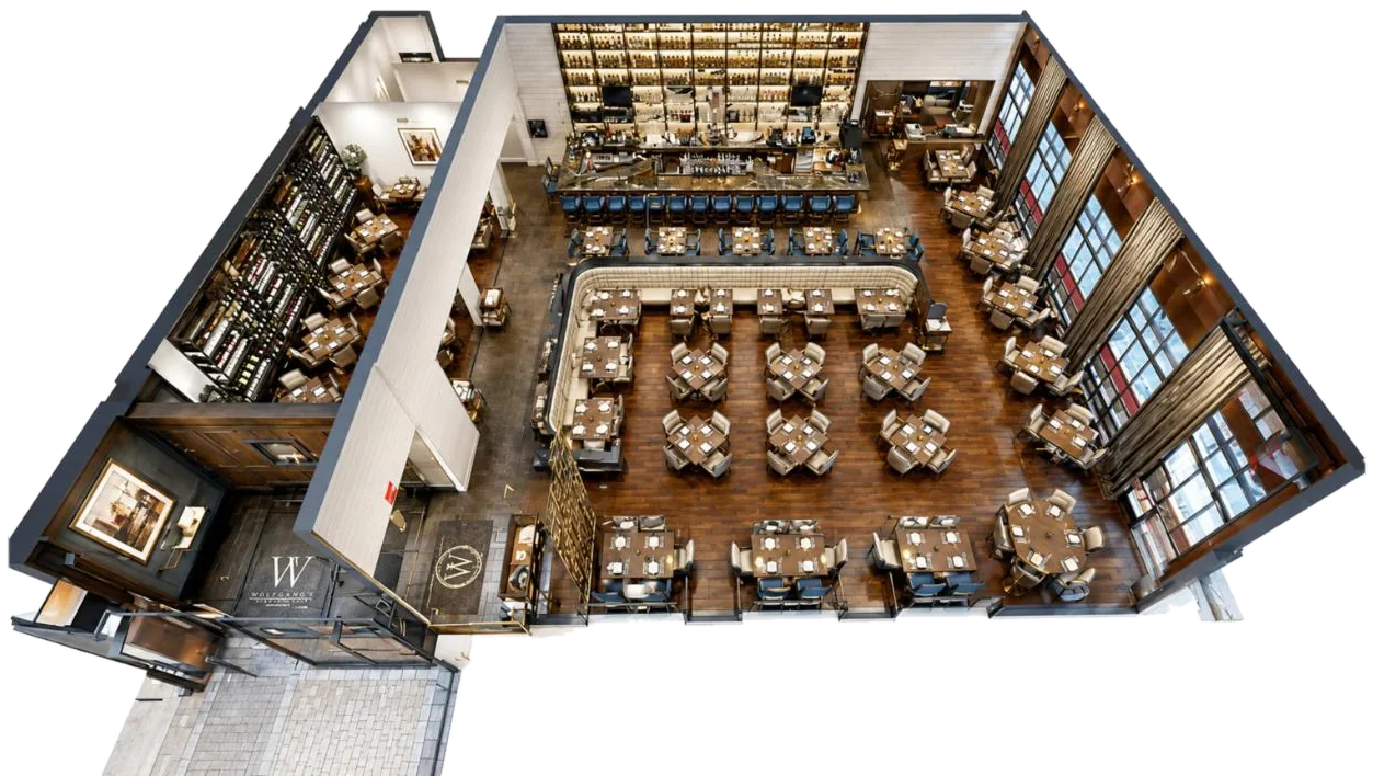
Ballrooms and meeting spaces that planners can walk and measure remotely.
Remote site visits · floor plans · faster bookingReal captures from the Acosta portfolioStadium · performing arts · ballpark
We work off-hours, between load-outs and around game days, so the venue keeps running while it gets captured.
We walk the venue with your ops or production lead and agree on zones, accuracy and deliverables.
LiDAR and Matterport scanning scheduled around events, with minimal disruption to staff.
Scans are aligned, cleaned and checked against control measurements before anything ships.
Point clouds, twins and plans delivered in your formats, with updates when the venue changes.
Two tools, two jobs. A Matterport twin is the fastest way for everyone to walk a venue. A survey-grade laser scan is what designers and riggers measure from. Drag across the capture to compare.
e.g. Matterport Pro3 LiDAR camera
e.g. Leica RTC360 terrestrial scanner
What do you need it for?
Accuracy and range are the manufacturers' published specs for the example devices. Equipment for each project is confirmed during scoping.
Straight answers about scanning a venue. If yours isn't here, ask it in the scope builder below.
A digital twin is a measured 3D copy of your venue that opens in a browser. Operations teams use it to plan events and renovations, production teams to advance shows, and sales teams to tour suites and sponsor spaces without a site visit. Everyone works from the same model.
Matterport is the fastest way to give everyone a walkable model, with stated accuracy around ±20 mm at 10 m. A survey-grade laser scanner measures to a few millimeters and is what designers and riggers build from. Many venue projects use both. The comparison above shows the difference.
Point clouds usually ship as E57, the vendor-neutral standard, plus RCP/RCS for Autodesk ReCap or LAS for other tools. Drawings come as PDF or DWG/DXF. The Matterport twin is a hosted link, with mesh and point exports available from its download package.
For walkthroughs, layouts and general planning, centimeter-level accuracy is plenty. For trim heights, steel positions and clash checks, design teams work from millimeter-level laser scans. A scan documents what is there; load ratings and structural decisions still go through the venue's engineer.
Scanning is non-contact and quiet, so it can work around operations. Empty spaces scan cleanest, because moving people and equipment leave artifacts, so captures are usually scheduled overnight, between events or on off-days.
It depends on how many zones you need, the accuracy and the access windows. A single zone, such as a club level or a stage house, is a short job. A full bowl with concourses and back-of-house takes several sessions. You get a schedule after the site walk.
Agree on it before the scan. Ask for the registered point cloud and drawings as files you keep, alongside the hosted tour, so your venue record isn't locked into one platform or subscription.
Price is driven by square footage, number of zones, accuracy, deliverables and travel. A pilot zone is the lowest-cost way to see the data on your own venue. Use the scope builder below to request a quote for your space.
Going beyond simple scans to deliver usable, intelligent data for real-world execution.
Acosta Spatial Collective was built from over a decade of real-world experience operating inside some of the world's most complex live-event environments: world-class stadiums, performing arts centers and international venues.
That operational background is the difference. We understand how these spaces actually function on show day, so the data we deliver is shaped around the decisions your team needs to make.
Pick what you need and your project brief builds itself. We reply with a scope and a site-walk date.